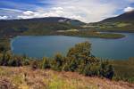
Stock photo: Aerial View abstract Small Rocky Island on Lake Superior taken on flight from Thunder Bay Ontario Ca
Stock photo of a small rocky island with a clear view through the water to the rocks below in Lake Superior during a flight from Thunder Bay, Ontario, Canada.

Stock Photos from the collection "Illuminated Stock Photos"

 = click to scroll forwards/backwards
Aerial View abstract Small Rocky Island on Lake Superior taken on flight from Thunder Bay Ontario Ca
This stock photo shows an aerial view of a small rocky island with a clear view through the water to the rocks below in Lake Superior during a flight from Thunder Bay, Ontario, Canada. The water is so clear and blue that when taking a flight from Thunder Bay over the small islands in Lake Superior that you can see right through to the rocks underneath the islands. Not only is Lake Superior the largest of the Great Lakes, it also has the largest surface area of any freshwater lake in the world. It contains almost 3,000 cubic miles of water, an amount that could fill all the other Great Lakes plus three additional Lake Eries. With an average depth approaching 500 feet, Superior also is the coldest and deepest (1,332 feet) of the Great Lakes. The lake stretches approximately 350 miles from west to east, and 160 miles north to south, with a shoreline almost 2,800 miles long. The drainage basin, totaling 49,300 square miles, encompasses parts of Michigan, Minnesota, Wisconsin and Ontario. Most of the Superior basin is sparsely populated, and heavily forested, with little agriculture because of a cool climate and poor soils.
Related stock photo search terms for:
Aerial View abstract Small Rocky Island on Lake Superior taken on flight from Thunder Bay Ontario Ca
- Abstract Stock Photos (8)
- Aerial Stock Photos (30)
- Aerial View Stock Photos (28)
- Aerials Stock Photos (22)
- Canada Stock Photos (650)
- Central Canada Stock Photos (198)
- Concept Stock Photos (69)
- Concepts Stock Photos (69)
- Conceptual Stock Photos (69)
- Design Stock Photos (8)
- Ecology Stock Photos (337)
- Ecosystem Stock Photos (336)
- Environment Stock Photos (337)
- Environmentalism Stock Photos (337)
- Forest Stock Photos (72)
- Great Lakes Stock Photos (109)
- Horizontal Stock Photos (429)
- Lake Stock Photos (70)
- Land Stock Photos (171)
- Nature Stock Photos (239)
- No People Stock Photos (497)
- North America Stock Photos (613)
- Ontario Stock Photos (194)
- Region Of Lake Superior Stock Photos (39)
- Region Of Thunder Bay Stock Photos (23)
- Scenery Stock Photos (287)
- Water Stock Photos (195)
Stock photo of a small rocky island with a clear view through the water to the rocks below in Lake Superior during a flight from Thunder Bay, Ontario, Canada.

 Request Image License
 Create a lightbox
 Add to favorites